31 May 2026,
Sunday
31 May 2026,
Sunday

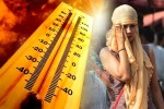
Intense heat to hit MP now (Photo Source: Patrika)
MP Weather Update: The spell of storms and rain in Madhya Pradesh has subsided, and the weather is rapidly changing. Heat has suddenly intensified, leading to a rise in both day and night temperatures. Over the past 24 hours, temperatures in most parts of the state have increased by 1 to over 5 degrees Celsius.
The most significant temperature surge was recorded in Indore, Ujjain, and Gwalior, while the impact of the heat was also evident in Bhopal and Ratlam. Ratlam saw the highest increase of 5.4 degrees Celsius. Temperatures are expected to rise further on Saturday, indicating a continuous intensification of heat.
According to the Meteorological Department, a new weather system is expected to become active from April 15. However, it is not anticipated to be strong enough to bring about significant changes in the state's weather. Therefore, the period of intense heat is likely to continue across the state, with no major relief expected in the immediate future.
In the last 24 hours, Narmadapuram recorded the highest temperature in the state at 39.3 degrees Celsius. This was followed by Ratlam at 38.6 degrees Celsius and Khargone at 38 degrees Celsius. The maximum temperature in Dhar, Khandwa, Narsinghpur, and Khajuraho was recorded at 36 degrees Celsius or higher. Among the major cities, Ujjain was the hottest with a temperature of 35.5 degrees Celsius. Bhopal and Jabalpur recorded 34.6 degrees Celsius, Indore 35 degrees Celsius, and Gwalior 33.4 degrees Celsius.
Meteorologists state that the second fortnight of April typically brings intense heat. Just as December-January are peak winter months and July-August are peak monsoon months, April-May are the peak summer months. This trend is now becoming apparent this year.
This year, April began not with intense heat, but with storms, rain, and hailstorms. From April 1 to 9, the weather remained erratic in various parts of the state. Rainfall was recorded in approximately 45 districts, and hailstorms occurred in over 15 districts.
This year, weather changes were observed four times each in February and March. In several instances, rain, storms, and hailstorms caused damage to crops. The weather remained unstable until the end of March, but now the state has seen a permanent arrival of heat, which is expected to intensify across most regions in the coming days.
- Drink plenty of water throughout the day.
- Avoid direct sunlight during the afternoon.
- Wear light and cotton clothing.
- Take special care of children and the elderly.
Big News
View AllBhopal
Madhya Pradesh
Trending