30 April 2026,
Thursday
30 April 2026,
Thursday
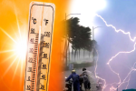
Weather U-Turn in MP (Photo Source: Patrika)
MP Weather Updates: The weather in Madhya Pradesh is likely to change over the next four days due to an active upper-air cyclonic circulation over the northeast Arabian Sea and the influence of a strong subtropical westerly jet stream over northwest India. The advance impact of a western disturbance, expected to become active from March 6, may lead to increased cloud movement and the possibility of light rainfall in parts of the state.
Under its influence, Malwa-Nimar, Bhopal and surrounding areas may experience drizzle with thunderstorms. A slight drop in temperature and strong winds are expected to keep the daytime weather relatively pleasant.
On Tuesday, the weather in Madhya Pradesh remained completely dry, with intense heat beginning to be felt in the western parts. The maximum daytime temperature in all divisions of the state, except Pachmarhi, was recorded between 32 and 35 degrees Celsius. The mercury crossed 35 degrees in Dhar, Narmadapuram, Khandwa, Khargone, and Ratlam. According to the Meteorological Centre, the maximum daytime temperature increased by 2 to 4 degrees on Tuesday.
Furthermore, the maximum temperature across the state is expected to rise by up to 4 degrees in the next four days. In this scenario, it is anticipated that the mercury could reach 40 degrees Celsius within the first fortnight of March. However, there is a possibility of light rain due to the Western Disturbance. A Western Disturbance is becoming active in the Western Himalayan region, the effects of which are likely to be seen in many areas of MP within the next 2 to 3 days.
Big News
View AllBhopal
Madhya Pradesh
Trending